
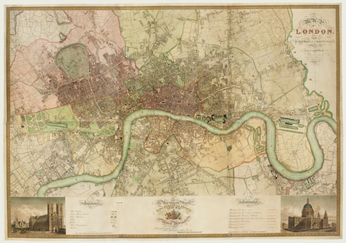
Our Favorite this week is a resource I’ve used countless times, both as a writer and a reader. It’s a clickable, interactive map of London originally published in 1827 and based on a survey of the city that took the previous two years. The scale is eight inches per mile, so the detail is amazing. And Bath Spa University (who hosts this particular version) has done a phenomenal job digitizing the map–you can zoom in several times and still get a beautifully clear picture.
Click the picture for more information:

This seems an excellent resource. I’ve made a note of the link.
LikeLike
I’ve used it quite a lot–and I love that you can zoom way in!
LikeLike
I love maps. Can’t write a historical romance without one!
LikeLike
I’ve found that I have a hard time reading some historicals without a map–but that might just be me 🙂
LikeLike